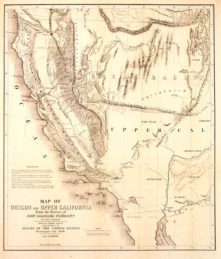
Map of Oregon and Upper California from the Surveys of John Charles Fremont and other Authorities.
N/P: N/P, 1850. 19.5 x 16.5. This is the smaller version of Fremont's tremendously influential map published in 1848. It is really a synthesis of al the available information collected by a number of western explorers including such famous names as Abert, Peck, Emory and Kern. It appears to be printed from a portion of the plate used for the larger map, and was probably issued to meet the demand for maps following the discovery of gold in California. The name notwithstanding, Oregon is not shown, but the map does show all of the Great Basin and routes to the diggings. There is much god information on the west as it was known, but one glaring error places a range of mountains east-west across the Great Basin. These nonexistent mountains would appear on commercial maps for years afterward. Still, it is outstanding for its depiction of California, and has a better depiction of Fremont's explorations in the Central Valley than the earlier map.Dated 1848 but issued in 1850. Folded as issued, a couple of age spots, else clean and bright. What (TM) 613, (in) Wagner Camp 150, Wheat (Gold Rush) 41. Item #26306
Price: $650.00