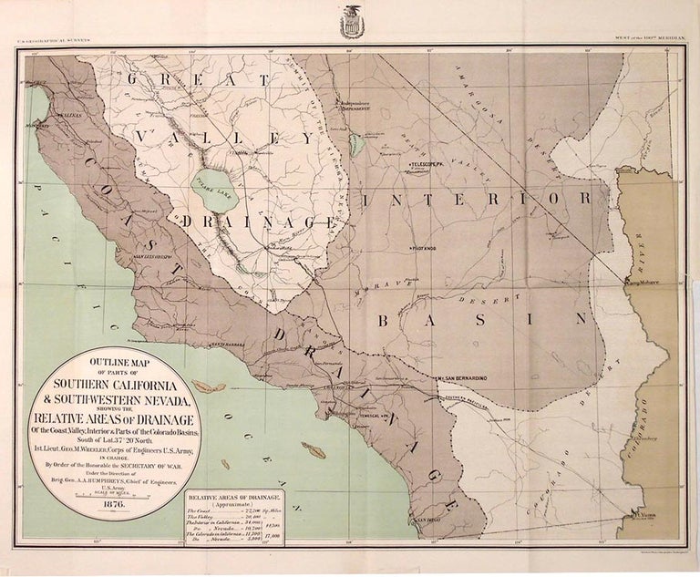
Outline Map of Parts of Southern California & South-Western Nevada, Showing the Relative Areas of Drainage of the Coast, Valley,
NP: NP, 1876. 14.5 x 19. A visually impressive map that makes use of several printed colors and textures. The title pretty well describes it; the map displays an area from San Diego and Ft. Yuma in the south eat to Santa Cruz on the Pacific in the north west. the colors show drainage area and basins, while major geographic and built features are named. The "Visalia Div. S.P.R.R." runs down the Great Valley Drainage past Tulare Lake. (Tulare Lake was once the largest fresh water lake west of the Great Lakes. It is now a dry basin, "reclaimed" for agriculture and housing developments.) The "Old Salt Lake Road" runs northwest out of the Los Angeles area through a miniscule Last Vegas. From Appendix JJ of Wheeler's 1876 Annual Report Upon the Geographical Surveys West of the One Hundredth Meridian. Folded as issued, else bright. Item #26300
Price: $150.00