
Map of San Jacinto Co.
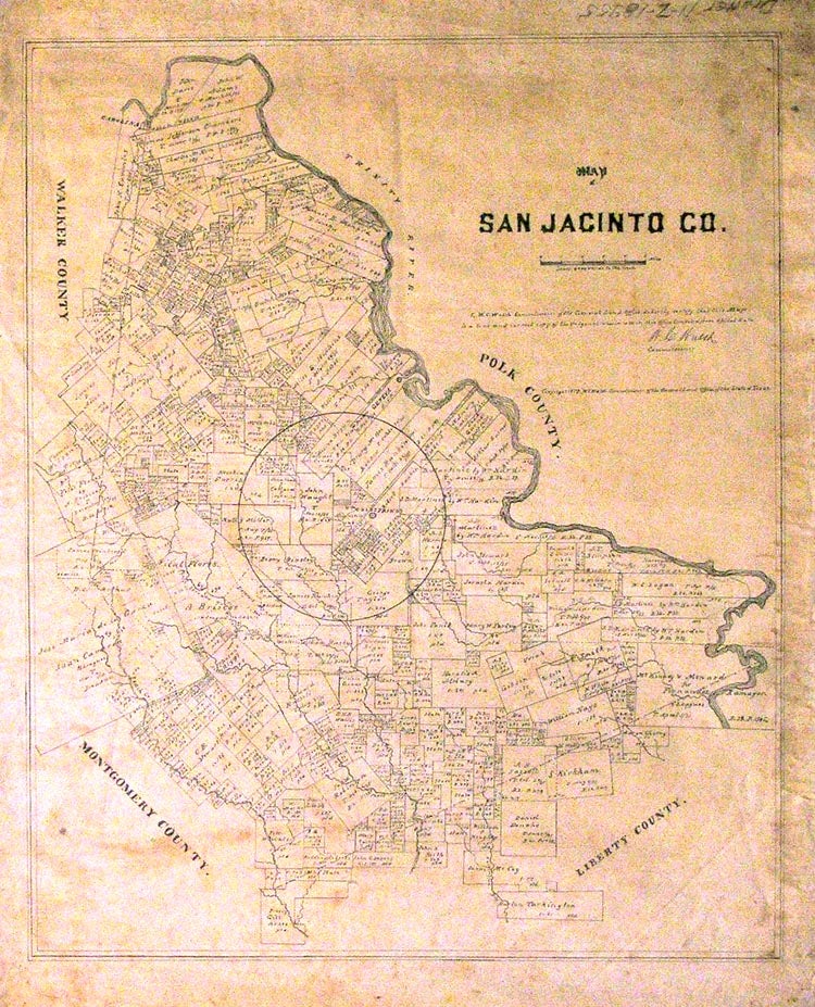
NP: Texas General Land Office, 1879. 21 x 17. This is a manuscript copy of a map in the Texas General Land Office. A legend reads, "I, W.C. Walsh Commissioner of the General Land Office, do hereby certify that this Map is a true and correct copy of the Original now in use in this Office compiled from official (sic) data. W.C. Walsh (signature) Commissioner." San Jacinto County, in southeast Texas fifty miles north of Houston on the Trinity River, was created in 1870 out of parts of Liberty, Montgomery, Polk, and Walker counties. One of my references says the county was named for the water hyacinth that choked area streams, the Handbook of Texas claims it was named after the battle; take your pick. For a lengthy history of San Jacinto County see the entry in the Handbook. Texas is the only public land state with complete control over its public lands and it is also responsible for collecting and keeping records, providing maps and surveys and issuing land titles. This tracing was probably made for use by the County, a municipality, or private developer. And a remarkable piece of work it is. Every land owner in the county is named, the smallest in script so minute and yet completely legible (albeit with the use of a glass) that I have a hard time imagining the skill, steady hand, and close eye that went into its making. Hand drawn on unfolded tracing paper. Some foxing, pencil notes in the margin, a dampstain enters the right margin. Not unique - tracing is just another form of duplication, after al - but try to find another one. Item #26298
Price: $995.00