Florida.
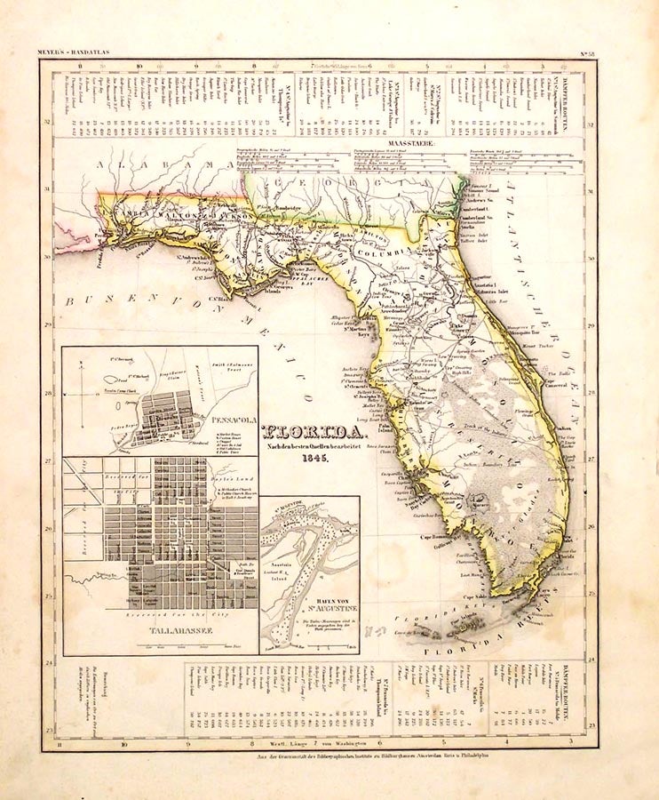
N/P: Meyer's Handatlas, 1845. 14.5 by 12. A copper engraved map, with elegant outline coloring from Meyer's Handatlas, the dated the year Florida was admitted to the union. Only 18 counties are named; there are 67 today. Two "Indian Boundary Line" and an "Undefined Indian Boundary Line" outline a large, central "Indian Reserve," which is crossed by a "Track of the Indians." (These legends are in English.) By far the majority of named places are in the north and panhandle, but a few are along the southern coasts including "Arredondo's Grant" in the vicinity of present day Gainesville. Not unlike New Mexico, Florida had numerous Spanish land grants with confusing boundaries, fraudulent claims, and inadequate - or nonexistent - surveys that plagued settlers and slowed development for decades. The Arredondo was one of the largest and most vexatious of these grants. There are three insets on the map, one of the harbor of St. Augustine with soundings in fathoms, and two town plans of Pensacola and Tallahassee naming streets, important buildings, and several landowners. Flanking the map are seven tables of steamboat routes and distances between St. Augustine and Pensacola and various other places. Scattered foxing else unfolded and very good. Item #26246
Price: $375.00